Monday, September 27, 2010

Wexford and the Irish National Heritage Park

Last Saturday, I decided to take a little trip to the town of Wexford (map: http://bit.ly/97sFS2).  Now, if you took the time to actually look at that map and zoom out a bit, you can see that I lied when I said I took a “little” trip, seeing as how Wexford is on the other side of the country from Limerick.  Truth be told, I probably spent more time on a bus or waiting for a bus than actually exploring, but I still think it was a fulfilling day (and I hope my blog entry will exemplify that).

Anyway, Wexford was founded by the good old Vikings in the 9th century, but due to its close proximity to Britain, it was one of the first places taken over by the Normans (the rulers of England at the time) in 1169.  Like every other place in Ireland, it was sacked by Oliver Cromwell in the 1640s (who’s a really popular figure over here *cough*).  It was center of the 1798 Rebellion against British rule in Ireland, a rebellion that backfired since the solution to it was the Act of Union in 1801 which officially made Ireland a part of the United Kingdom.  But nowadays, Wexford is a nice harbor town on the Irish Sea where people like to park their boats:


Wexford is also relevant to us Americans as well since it was the birthplace of John Barry (1745-1803), a man who fought as a naval officer for the Americans in the Revolutionary War, and would be appointed by George Washington as the first head of the newly created United States Navy in 1797.  As thanks, the United States government gave the town of Wexford this lovely statue of Barry in 1956, which currently stands, sword in hand, facing the harbor and, probably not coincidently, Britain (just to be on the lookout in case they try anything again):


Anyway, I wanted to come to Wexford mainly for a place called the Irish National Heritage Park, which was a good 3 km. walk from the town (the lady at the tourist office said it would be a nice walk, but failed to tell me that the last kilometer would be on a busy highway with no sidewalk).  It’s basically a trail that reconstructs Irish history from the Mesolithic period nine thousand years ago to the Norman invasion of the 12th century.  For example, they recreated what a typical house would have looked like for an Irish family that lived in 7000 BC:


The house is rather cozy (real estate jargon for small), not because they didn’t have enough materials to build a bigger one, but because people were very nomadic; they only built simple houses because they were going to move to another location at any moment.  However, when traders from Britain introduced the idea of farming to Ireland around 4000 BC, people didn’t need to be nomadic anymore, and they started building bigger houses (at least the British did something helpful for the Irish!).  Anyway, the further you walk down the trail, the further forward you move through time.  By the first century AD, you start seeing small communities:


By the year 600, you start seeing Christian monasteries:


By 800, you see Viking towns and longships:


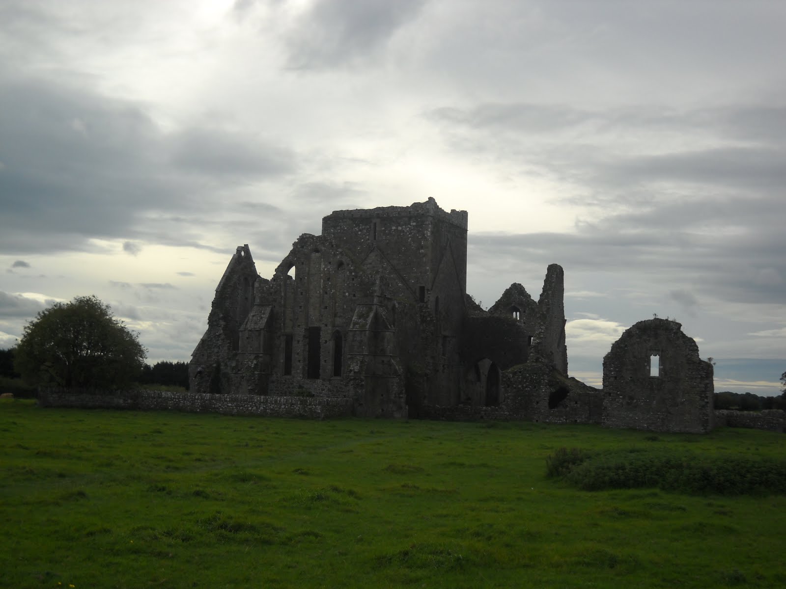
And by 1200, you see Norman forts and castles:


As a history geek, it was very interesting to see a lot of things that I’ve read about in boring old books reconstructed and brought to life right in front of me.  I only wish I was here during the summer, because there are reenactors and everything within the different periods of time (building fires and farming and praying and dancing jigs and stuff like that).  I didn’t want to bore everyone to death with what I learned here on the blog, but if you click on the link on the right side of the page labeled “Wexford Pictures,” there I’ll have pictures and explanations of many things there within the park.

Anyway, I made it back in town with just enough time to eat something and then explore the coast of the Irish Sea.  No beaches with sand or anything like that, but lots of rocks and bushes (there were still lots of lovely seagulls though!).  Here’s what I saw, including a somewhat-interesting sunset from the bridge:


So that was Wexford!  My next destination looks to be the Cliffs of Moher next Saturday, so get all excited about that one.  Also there’s a new poll, where I ask you how I can make my blog even better (sorry, providing shirtless pictures of myself is not one of the choices).  As always, thanks for reading!

Sunday, September 19, 2010

County Tipperary: Cahir and Cashel

This weekend, I decided to hop on a bus and travel to the county east of Limerick, Tipperary.  Tipperary (often just called “Tipp”) is one of those places that is all farmland with a bunch load of cows, and then a random town with a shopping mall, a few pubs, and a post office every now and then (so sort of like central Pennsylvania).  Also, Tipp is covered with blue and yellow flags, in order to celebrate their recent victory in the All-Ireland Hurling Championship:


Hurling is pretty much like baseball and soccer combined, and was probably invented by some drunk people late one night (like most sports).  Anyway, I decided to check out two of Tipp’s random towns: Cahir and Cashel.  Cahir (pronounced like care; map: http://bit.ly/991IzF) is notable for its rather large castle, visible right away from where the bus dropped me off:


You’re allowed to explore the castle on your own, but for fun, I decided to fall into a guided tour with a group of Swedish senior citizens (complete with a tour guide that spoke English, and a Swedish translator promptly repeating what he said).  Anyway, Cahir Castle was built by some rich noble dude in 1142, and was inhabited by the Barons of Cahir all the way up until 1961.  Obviously, the Barons of Cahir were pretty short, because I had a hard time fitting through some of the doors:


The most notable thing to happen at Cahir Castle was the Siege of Cahir Castle in 1599, which occurred because Elizabeth I of England was sick of the Irish being rebellious all the time.  After three days of fighting, Robert Devereux, the Earl of Essex, was able to capture the castle.  The battle is immortalized within the castle itself by a cannonball that is still embedded within the castle wall, even after four hundred years:


Anyway, next the bus dropped me off 15 kilometers north of Cahir in the town of Cashel (map: http://bit.ly/bHZAWa).  Cashel is notable for a place known as the Rock of Cashel, a rocky hill that juts above the town proper and was once home to a popular cathedral:


The historic kings of Munster (southwest Ireland) called the Rock of Cashel home as early as the 5th century, and legend goes that St. Patrick even converted the Munster king (and thus, all of Munster) to Christianity on top of the Rock.  One of the Munster kings that resided on the Rock was Brian Boru, the first man to become King of all of Ireland shortly before his death, and is the first person in recorded history to bear the name “Brian” (represent!).  Anyway in 1101, the Rock was given to the Catholic Church, who proceeded to build a nice, big, pretty cathedral:


That last picture is a replica of the old Latin cross that had been there for centuries.  Legend has it that if you give the cross a hug, and you can put your arms all the way around it, then you will never have a toothache again.  Random, I know, but at least I’ll never have a toothache again!  Finally, at the bottom of the Rock is an old 13th century abbey known as Hore Abbey (tehehe):


The abbey is now in the middle of some farmer’s land, but the tourist office in Cashel told me that he doesn’t mind if you hop the rock wall around his property and check out the abbey (as long as you don’t mess with his cows).  So that’s exactly what I did!


Not visible in the pictures are all the couples that apparently come to the abandoned abbey to make out (is that why they call it Hore Abbey?).  In response, I sat in the grass in the middle of the former great hall and chilled for an hour with one of my true loves: Pokémon Sapphire on Game Boy Advance.  Now that’s what I call a good time!

Alas, the weekend is over, and I have to return to classwork.  However, keep my blog as one of your “Favorites;” who knows where (or when) I’ll travel to next!

Friday, September 17, 2010

Limerick City: The Williamite War

The English have done their fair share to screw over the Irish, but here is Limerick’s most notorious example.  James II became King of England, Scotland, and Ireland in 1685, but was immediately unpopular mostly due to the fact that he was a Roman Catholic, and not Anglican Protestant like most of England (and most importantly, Parliament) was at the time.  However, he was very popular in Ireland, which was mostly Catholic, and proceeded to give Catholics freedoms that they haven’t experienced since before the English Reformation (aka: when Henry VIII didn’t like his wife anymore and wanted to behead her...I mean, divorce her) over a hundred years prior.

Finally in 1688, Parliament invited James’ Dutch son-in-law, William of Orange, to bring over an army and get rid of the Catholic king.  James fled to the protection of his cousin, Louis XIV of France, while William of Orange was crowned and became William III of England.  However, James (right) and Louis (left) began scheming about how to get the crown back:


James decided to go to Ireland, where he was still popular, and regain his crown there.  So, with money and troops courtesy of Louis, he arrived in Dublin in 1689 and was well received with a parade and everything.  William got a little grumpy about his father-in-law deciding to take over Ireland (wouldn’t we all be?), and he arrived with his army soon thereafter.  The largest battle between the two was the Battle of the Boyne (just north of Dublin) on July 12, 1690, depicted in this lovely painting that I whipped up really quick myself (*cough*):


James was defeated and fled back to France, where he would stay for the remainder of his life, while most of his army marched westward to a lovely city by the name of Limerick.  They took refuge in King John’s Castle, and even set up houses and passageways underneath the castle that visitors can still check out today:


William was having his way with the rest of Ireland however, and by 1691, Limerick was the only major Irish settlement that was not under his control.  That changed following the lengthy Siege of Limerick, in which the entire city was bombarded by William’s army.  The city finally surrendered and the war was ended by the Treaty of Limerick, which was signed on a large rock known as the Treaty Stone (the rock is now perched upon a monument just outside King John’s Castle):


The Treaty of Limerick stated that, while Ireland would be ruled by the Protestant William III, Catholics would be free to own land and freely practice their religion.  Also, soldiers loyal to James (along with their families) would be permitted to leave Ireland; thus 24,000 Irish people migrated to places such as Spain, France, and Austria (where Catholicism was still the dominant religion), an event known as the Flight of the Wild Geese.  Unfortunately for the Catholics who stayed in Ireland, Irish Parliament (which was dominated by English Protestants who settled in Ireland) rejected the terms of the treaty, and Catholic persecution continued in Ireland for another century and a half.  This gave Limerick one of its nicknames: The City of the Broken Treaty.

The war between James II and William III is still relevant today in Northern Ireland, the northeastern section of Ireland that remains under the jurisdiction of the United Kingdom.  Every year on the “Twelfth of July,” Protestants celebrate the Battle of the Boyne by marching through the streets with British flags and Orange banners (because of William of Orange, and thus they are typically called “Orangemen”).  Here's a stock photo of it courtesy of Wikipedia (where all the professional historians go for evidence):


It is a controversial day, because Orangemen typically march through Catholic neighborhoods and taunt them for the loss that “they” suffered over three hundred years ago (they should have tried harder).  These parades often added to the conflict known as the Troubles during the last century (which I’m sure that I’ll cover once I go up and visit Northern Ireland).

I hope you enjoyed this history lesson!  Just be happy I’m not charging you tuition for any of this.

Monday, September 13, 2010

Kerry Way


See that extremely large hill there?  I climbed that puppy!  And did it while hacking my lungs out too!

My first trip with the Outdoor Pursuits Club took me westward to County Kerry on a little hike known as the Kerry Way (for the location to where I was, click here: http://bit.ly/bXXzF3).  Basically it takes you up and through the woods in order to see great views of Ireland’s largest mountains…


…greenest farmlands…


…and friendliest sheep.


I’m sure I would have enjoyed the trip a lot more if I had a voice and my head wasn’t pounding out of its skull.  Long story short, I started feeling sniffily on Thursday, and it’s been getting worse ever since.  I don’t know if it’s the Irish weather (there hasn’t been a day without rain since two Saturdays ago) or if I’m allergic to Irish classes (I guess I better stop going then), but something’s got a hold on me.  Luckily, I have these Irish cough drops called “Strepsils” which, as unhappy as the name sounds, actually work better than any American cough drops I’ve tried.  It’s good craic!

I guess I should explain craic, shouldn’t I?  It’s basically an Irish word that can be used for anything at anytime, but mostly used to denote fun.  It’s most often used in the phrase, “It’s good craic!” meaning “It’s a heck of a lot of fun!” or “Where’s the craic?” as in “Hey, where are the fun times to be had?”  It’s pronounced the same as “crack,” so you can imagine what I was thinking the first time I heard someone say, “Where’s the craic?” (I believe my thought was, “Is there a drug-deal going on here?”).  It can also be used as a salutation (“What’s the craic?”) or an exclamation (“Oh, the craic is on!”) or a permutation:  


No matter how you use it, it’s all just good craic!  Hopefully I’ll get better soon so I can properly enjoy my Irish experience without being all sickly and gross (not the best way to make friends).  Either way, I’ll keep the craic going for my blog!  That didn’t sound right…

Friday, September 10, 2010

Limerick City: King John's Castle

There once was a king named John
Who certainly was no Genghis Khan
His powers were resigned
When the Magna Carta was signed
And now he’s less of a king than a pawn

There you go, a crappy historical limerick for you!  But it relates directly to the highlight of my first trip into the city of Limerick: King John’s Castle.


King John’s Castle was built in 1197 and named after the Lord of Ireland at the time, Prince John, who was the youngest brother of the reigning English king, Richard I (or Richard the Lionheart).  When Richard died without an heir in 1199, John became King of England, which possibly changed the name from Lord John’s Castle to King John’s Castle.

Now, if you ask any fairly-historically minded Englishman, they will all tell you that John was a bloody awful king.  He lost a lot of land to the French (including Normandy, where his family actually originated), he was forced to sign the Magna Carta, which gave away many of his powers to the aristocracy (barons, dukes, lords, things like that) so they could more easily repress the peasants, he increased taxation as a result of his losing land and power to his foes, and he got himself excommunicated by the pope!  If that wasn’t enough, you know the story of Robin Hood?  Yeah, this is that King John.  No wonder why he looks so gloomy:


Anyway, at least the castle that was named after him is pretty cool!  You can freely wander around the courtyard of the castle, and navigate your way to the top of the castle walls.  Check out some pictures:


That last one is the view of the Shannon (and the hills of County Clare) from the castle’s main turret.  Almost makes you want to live in a late-twelfth century castle in the middle of Ireland’s fourth largest city, doesn’t it?  Maybe that’s just me.

On the way back from King John’s Castle, I checked out something that’s even older (and is actually the oldest building still in use in all of Limerick): St. Mary’s Cathedral:


I couldn’t check out the inside because there was a wedding going on in there (the parking lot was packed with cars).  But still looks sweet from the outside, doesn’t it?  It was built in 1168 as a Catholic church, and then (like all major old cathedrals in Ireland) was turned Protestant by the English in the sixteenth century.  As a side note, whenever I tell an Irish student that I’m interested in Irish history, they always say, “Let me sum it up for you.  The English invaded.  Eventually we kicked them out.  Repeat.”  The English sure left their mark every time they came over, that’s for sure.

Thanks to all of those who voted on the poll.  It’s seems like most of you are pretty jealous that I made it to Ireland.  I’m not going to lie, I kind of like that feeling.  Anyway, a new poll is up, so check it out!  I am also providing links to more pictures on the side, so check that out too!  I know, it’s a lot of checking, but you’ll live.  Next, I'll be travelling westward into County Kerry (arguably the most beautiful part of Ireland...mostly argued by people from Kerry), so (once again) make sure to check in later as well!

Monday, September 6, 2010

What the Bloody Deuce is That?

So I was looking out the window Sunday morning, enjoying my bagel with Nutella, when I spotted something in the distance.


Do you see that?  That block of something just above the tree line?  I wondered for quite a while about what that was (so long that I had to have another bagel with Nutella), so I decided to go on a little trek to investigate (lucky for you I brought my camera).  Suddenly, as I was walking down the river path, I looked left and saw this:


I crept through the woods for a closer look, and I found a strange stone spire with an alcove inside of it and winding stairs that went all the way to the top.  Here it is really up close:


I have no idea what this ruin is for!  My guess is that it was a lookout built along the Shannon, made so that the region’s inhabitants could be forewarned as to what sort of trouble was sailing up the river (damn English!).  I can’t even take a guess how old it is, but I think I can safely assume that it was built before the Act of Union in 1801.  I would like to think the Vikings made it after they built their settlement of what was to become the city of Limerick in the year 812, but I doubt something that old could have retained its shape without proper care, and it seriously looks as though it has fallen by the wayside.  However, I think some other college kids have noticed it before, judging by all the beer bottles and cans littered all around and inside of it:


Damn English!  Anyway, today was the first day of classes here at UL.  As a study abroad student, I am actually allowed to attend whatever classes that I want for the first week, and then pick which five I would actually like to continue taking.  That way, I get a feel for the class before I have to commit to it.  I wish that was true at Susquehanna, or else I would have never dealt with many of the professors that I suffered through in years past (without naming names…I’d like my blog to remain classy, thank you).  In the social department, I’ve been making a few friends, both Irish and American (with a little of French as well).  A group of Irish friends have convinced me to join their club (the Outdoor Pursuits club), which travels to the various regions of Ireland and goes on hikes and bike rides and such.  It’s funded by the university, so it would be a cheap way to travel and see more of this fantastic country (with random ruins all over the place)!

Tomorrow I will be going into Limerick city to register with the Immigration office, so I hope to be doing a little exploring and picture-taking there (maybe the Immigration guy will pose for a portrait with me).  Seachain i gcathair na stab!

Sunday, September 5, 2010

University of Limerick


Well, I’ve been here at the University of Limerick for four days now, and I like to think I know my way around.  One thing that I’m certainly pleased with is my room:


Not completely visible in this picture is the queen size bed that I happily roll around in each and every night (I didn’t want to take a picture of it because it wasn’t neatly made, and I wouldn’t want my readers out there to think of me as a messy slob…at least not as much of one).  But anyway, check this out:


See that?  That is MY OWN BATHROOM!  Mine, all mine!  It’s not much, but at least I’m not sharing it with disgusting guys who take forever and don’t flush the toilet and leave their underwear in there all the time (good thing I flushed the toilet and took my underwear out before I took this picture).  Anyway, my suite is pretty cool too:


The sweet thing about my suite is that there’s a little balcony that a few people can stand on and wave to the other few people who are standing in their balconies (mainly used by my suitemates who like to smoke, but at least they’re not doing it inside).  Let’s get outside and see the nice landmarks of the campus:


This is the River Shannon, the longest river in Ireland, which just so happens to be right in my dorm’s backyard.  The river is actually the border between County Limerick (landmass on left) and County Clare (landmass on right), which allowed me to play the “Now I’m in Limerick, now I’m in Clare” game as I ran back and forth across the bridge.


This is the main academic building on campus, comparable to Bogar, Steele, and Fisher back on Susquehanna combined (I’ll be providing SU conversions during this tour so my college friends can better understand the campus).  The glass windows going down at an angle are known as the “Ski Slopes,” and are a popular meeting place.  It’s not a popular meeting place today, since most Irish students actually go home every weekend.  This is for many reasons: for their moms to cook for them, to do free laundry, to get some rest after a hard week of “studying” (or to continue “studying” with their friends back home).  It’s also easy for the Irish to go home since the other end of the country can be reached by car in two hours (I almost wish we can say that in the States)!  Anyway, below is the courtyard in front of the Students’ Union (SU: Deg), which looks extra dead on the weekends because it’s not even open!


On the other side of that is the Stables Club:


It’s pretty much a Benny’s, except that it looks kind of fancy, and there’s beer on tap (I can feel the jealousy of my Susquehanna friends resonating from here)!

There are other semi-interesting things on campus (with semi-interesting pictures to go along with them), but I’m not semi-interested in semi-entertaining you all night!  Go to my Facebook profile and view the pictures there if you would like to see all that campus (and Ireland as well) has to offer.  But I’ll leave you with a look of this baby:


Look at that!  Doesn’t that kick the crap out of Susquehanna’s fountain?  Just looking down at it, it seems as though the bottom goes down at least five feet below the surface!  The only problem is that, reportedly, if you go for a swim in it, you get expelled (at least that’s what my orientation tourguide told me).  I think I might have to test the waters with that…Dáiríre!