Sunday, November 7, 2010

Irish Blitz: Killarney, Kilkenny, Dingle, Blarney, and Cork

Alright, a lot to cover here, so no screwing around.


Aw, look at the little puppies!  Look at their floppy ears!  They’re so cute!

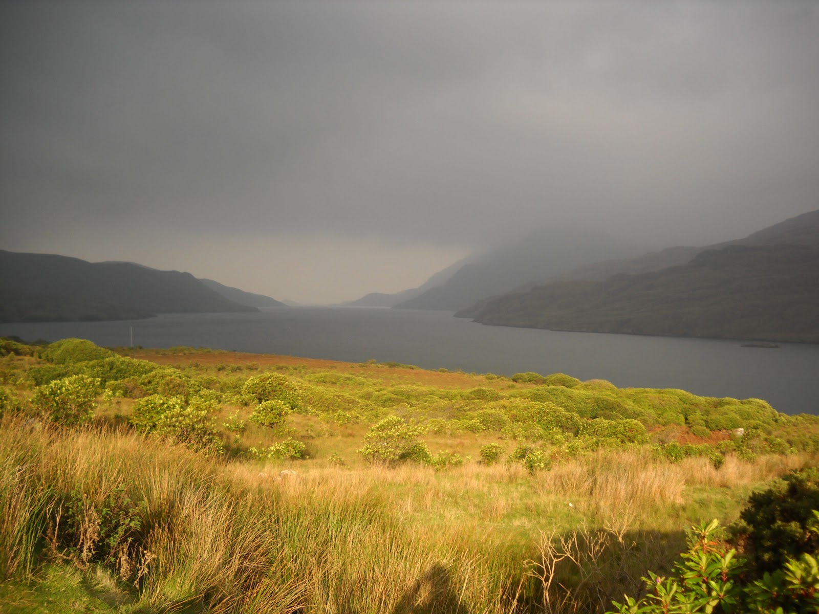
Ah, no screwing around, I said!  Sorry, got distracted there.  Well, I was fortunate enough to have members of my family come and visit me for the past week!  Last Saturday, my mom, my Aunt Annie, and my cousin Karen arrived in Ireland, happy, peppy, and full of jetlag.  Then the next day we caught up with my Uncle Johnny and Aunt Sue over in Killarney (map: http://bit.ly/b9XGwU), practically making it a family reunion (well, for the Hudacs’s, maybe 1/5th of one).  Killarney in County Kerry is an interesting town because it’s nestled around Killarney National Park, the largest national park in Ireland, which in turn is centered around the Lough Leane (lough being Irish for “lake”):


There are a lot of hiking trails around the park, including one to the magnificent Torc Waterfall:


Rickett’s Glen, eat your heart out!  There were many other sights to be been, such as the Muckross House, a Victorian mansion owned by the Herbert family which was actually visited by Queen Victoria herself in 1861:


Also there’s Ross Castle, a 15th century estate for the Earls of Kenmare situated right on the Lough Leane (unfortunately the inside was closed for the winter, but you can do silly stuff with the outside like I did in the last picture):


My family then took me to a pub for dinner, when Uncle Johnny told the waitress that it was my birthday a few days prior (I was unfortunately in the bathroom, so I couldn’t stop him).  Soon enough, the lights were dimmed, and the staff came out to sing “Happy Birthday” to me and present me with cake and ice cream on top a chocolate-drizzled message:


I guess I had it coming.  Anyway, on Thursday my mom, aunt, cousin, and I journeyed eastward to the city of Kilkenny (map: http://bit.ly/duo0q8).  Kilkenny is often called Ireland’s medieval city because the city’s layout, as well as many of the buildings, has remained unchanged since the middle ages.  The embodiment of this is the late 12th century Kilkenny Castle:


A fort turned mansion for the Butler family in the 15th century, its eastern wall was destroyed by (who else) Oliver Cromwell in 1650, giving it its current “C” shape.  The insides are furnished to look like it did in the early 19th century, with swanky portraits and libraries and dining halls (I’d show you pictures, but we weren’t allowed to take any, and I’m not that stealthy).  Another interesting building was St. Canice’s Cathedral, built in the 13th century:


I really liked the graveyard; many of the graves are so old that the engraving has completely eroded away.  Apparently, one of the graves is for John Kearney, who was a bishop until his death in 1813, and just so happens to be the great-great-grand uncle of Barack Obama.  Funny how that works out.

Next on the Irish Blitz is Dingle, an ocean town on the Dingle Peninsula in County Kerry (map: http://bit.ly/drtQoi).  Dingle is a very popular tourist town, and we were lucky enough to visit it in the offseason without the crowds (unfortunately that meant we couldn’t swim with Fungie, the Dingle Dolphin).  But we got to see boats and the ocean and stuff:


And I got my hand bitten off by a statue of Fungie:

My mom and I even ventured to the aquarium, where we got to see zebra fish, sharks being feed, and I got to touch a super friendly sting ray (it was practically jumping out of the water to say, “Hello!”).  On the way out, we took the scenic route known as Connor Pass, and (after some dangerously narrow roads down the edge of a cliff) pulled over to take in the sights:


Yeah, I think I can live up here.  Anyway, I had a lot of fun with my family, and I was very sad to see them go (along with their rental car, which gave me a nice vacation from stupid buses).  But the adventure just doesn’t stop for me!  The next day, the International Office set up a bus trip down to Blarney and Cork just to ensure that I remain traveling and sleep-deprived.  Blarney (map: http://bit.ly/b87VsB) is of course famous for the Blarney Castle:


And the even more famous Blarney Stone (stock photo provided because I couldn’t get a picture of it myself without paying €10):


Now, I made up my mind a while ago that I wasn’t going to kiss the stone.  Firstly, I’m one of those boring people that don’t believe in superstitions (the “gift of gab” seems pretty stupid and annoying anyway).  Also, my grandmother told me not to kiss the stone on her deathbed because (and I’m quoting here), “People pee on it.”  So I was planning on doing something else, like blow the stone a kiss or tell the stone that it wouldn’t be right to kiss because I didn’t think this relationship was going anywhere.  But then I gave into peer pressure (stupid cute French girls), and ended up kissing it after all (once again, no photo because I wasn’t paying €10).  It’s a rather nerve-wracking experience, because you have to lay down on a yoga mat and lean backwards under the castle’s battlements while holding onto these rails for dear life (even though there’s a safety cage underneath it as well).  To give you some perspective, here’s a zoomed-in picture from the ground, and the Blarney Stone is located just on the other side of where those handrails are:


Who thought of this tradition anyway?  After that fun time, the bus continued to the Republic of Ireland’s second largest city, Cork (map: http://bit.ly/cdAkQ4).  People from Cork seem to have a bit of a reputation in Ireland.  They happily call themselves “The Rebels,” a name they also give to their football and hurling teams.  Due to the county’s more socialist leanings, there are many signs and t-shirts saying that they are in the “People’s Republic of Cork.”  However, people outside of Cork seem to look at them like people in the United States look at people from New Jersey: self-centered and arrogant people who think their county is the only one that matters when it actuality it is quite overrated (hmm, I may have just lost friends thanks to that last sentence, from New Jersey and Cork).  Also, Cork parallels New Jersey with its bad drivers; as my family discovered driving around Ireland, anytime another driver does something stupid, like cut you off or pass you on a no-passing road, they almost always have Corcaigh (the original Irish name for Cork) on their license plate telling you where they’re from.

Well, now that I’m done bashing the hell out of Cork, let me tell you of my experiences there.  Unfortunately, we were only allowed three hours in the city, but that was enough to hit all the major points.  The coolest thing I saw was Saint Finbarre’s Cathedral, built only in 1879, but still pretty cool:


The entire outside of the cathedral is covered in statues and friezes, including some biblical figures outside of the doors:


From left to right, they are Philip, Bartholomew, Simon, John the Baptist, Andrew, James, Thomas, and Matthias.  Also interesting is the golden Angel of the Resurrection located on top of the sanctuary roof:


Legend has it that if the angel either falls or begins to play his horns, then the apocalypse is nigh!  Great, another thing we can blame on Cork!  Also in Cork are the English markets, where local produce, souvenir, and candy sellers entice tourists with their lower-than-average prices.  I also spent a great deal of time in the Crawford Art Gallary, which has a lot of portraits and replicas of marble statues in the Vatican:


So that was Cork and the Irish Blitz.  If you can’t tell, all this traveling is starting to wear me out, and I think I’m going to take a little bit of a break.  This will allow me some relaxation time for my beard to grow out for No-Shave November.  Here it is after the first week:


Little scruffy, but it’s getting there.  Anyway, I think I’m pretty much done exploring the Republic of Ireland.  I’ve now hit all the major points that I wanted to: Dublin, Galway, Cork, Kilkenny, Killarney, Dingle, Wexford, Cashel, Drogheda, Newgrange, Cliffs of Moher, and of course, good old Limerick.  I think I’m now down to three more adventures, all within the United Kingdom: (1) Edinburgh, Scotland possibly in two weeks, followed by (2) the capital of Northern Ireland, Belfast, with the Butler program for Thanksgiving, and then (3) a trip to Liverpool, England sometime in December (with a possible stop on the Isle of Man on the way back).  Of course, I’ll update my blog following these adventures, so keep reading like you guys always do.  A new poll is up, which is basically me just trying to figure out who my audience is, so please vote!  As always, thanks for reading!

Monday, October 25, 2010

A Stop in Galway, Then on to (London)Derry

For my first extended weekend trip, I decided to head all the way up north to the region that Irish people predictably call “The North.”  In order to have enough time for travelling and seeing everything that I wanted to see, I chose to leave on Wednesday night (don’t worry, Mom, I only missed two classes and I got the notes from both of them) and spend the night in Galway, which happened to be my original choice for my study abroad school (although it all worked out anyway, since I’m very happy in Stab City…I mean, Limerick).  Two very nice friends whom I met during orientation in Dublin allowed me to crash on their floor (they even gave me a yoga mat and an extra pillow!) before I checked out a bit of Galway the next day (map: http://bit.ly/ax8oix).  The main center of town is called Eyre Square, complete with sculptures and public bathrooms and people walking around and everything:


There was also this cool Roman Catholic church, officially named The Cathedral of Our Lady Assumed into Heaven and St Nicholas (in Irish: Ard-Eaglais Mhaighdean na Deastógála agus Naomh Nioclás), but usually just called Galway Cathedral (I don’t blame them):


There typically aren’t many Catholic churches in the cities of Ireland thanks to the English converting most of them to Anglicanism during the Reformation, but they sure make up for it by building them rather large and gaudy.  Unfortunately, I did not have much time to explore Galway since my bus northward was leaving at 3pm, and it didn’t help that I spent much of my day here:


This is a Supermacs, the Irish knock-off of McDonalds!  The first one was founded in 1978 further north in County Galway by a former school teacher who wanted to open a pool hall, but decided to go with a fastfood chain after he couldn’t get permission.  It’s now the largest Irish restaurant chain on the island, and they pride themselves on being Irish by only using Irish beef and chicken and staff (although I’m pretty sure the guy who served me had a Polish accent).  Anyway, I wanted to make sure I had a big lunch because it was going to be a five-and-a-half hour bus ride to Derry, and it was a good thing I did since it actually turned out to be a seven-and-a-half bus ride thanks to the traffic caused in what seemed to be the worst three-car-accident in the history of County Mayo (I literally watched the same cow in the field beside the road for two hours, and let me tell you, they sure live exciting lives).

Finally at around 10:30, I finally crossed the border into Northern Ireland!  I say “border” because Northern Ireland is actually within the United Kingdom, with British license plates and mailboxes and even currency (now I have £11 (pounds) sitting on my desk that I can’t use unless I go to England or something…hey, an excuse to go to England!).  Here’s a map showing the division of Ireland:


It all started in the early 17th century, when King James I of England decided that the best way to subdue those annoying rebels in the northern part of Ireland was to give land to loyal English and Scottish citizens so that they outnumbered the Irish there.  Obviously, those colonists brought over their Protestant religions as well, and the northeastern section of Ireland slowly became more Protestant than Catholic.  Skip ahead to 1922, when the Irish War for Independence actually led to Irish independence.  Since the majority of people in that northeastern part were the descendants of those English and Scottish Protestants, they decided they wanted to stay within the United Kingdom because they were religiously and culturally different from the Irish Catholics who now ruled the southern part of the island.  So the British government agreed, and split Ireland into the Republic and the North.

Derry is a city right on the border (map: http://bit.ly/93ivqL).  In fact, there is no sign telling you that you have crossed a border at all; the only reason I knew I was in Northern Ireland was that the speed limit signs changed from kilometers-per-hour to miles-per-hour, and that my cell phone alerted me that sending calls and texts was suddenly going to be more expensive.  If you clicked to look at that map, you can see that Derry kind of has an identity crisis (Google Maps doesn’t know whether to call it “Derry” or “Londonderry,” so it calls it both).  The city was originally called Derry until it was completely destroyed by the English in 1608.  Instead of actually “rebuilding” the city, the English instead claimed they were building a brand new city there, and when it was completed in 1618, they named the “new” city Londonderry, since the funding for the construction was provided by companies in London.  The cool part is that the walls surrounding the city are still there, and you can actually walk on top of them:


So while the city is officially called Londonderry, many of the Irish insist on calling it by its original name, Derry, creating a bunch of stupid hoopla.  But what isn’t a bunch of stupid hoopla is the bloodshed that occurred in this city during the time known as The Troubles (1968-1998), when guerrilla groups from both the Nationalist (those who want Northern Ireland to become a part of the Irish Republic) and Unionist (those who want Northern Ireland to remain a part of the United Kingdom) sides wrought violence throughout the country, resulting in the deaths of over 3,500 people (with over half of them being innocent civilians).  Derry was one of those places particularly effected, especially since the majority of its citizens are Catholics that live outside the city walls in an area known as the Bogside (because the houses are actually built upon a bog):


In 1969, sick of the discrimination by the Protestant Unionist government, Catholic Nationalists in the Bogside proclaimed themselves within the autonomous republic of Free Derry, with one citizen painting a sign welcoming people to the new country on the side of a building (whose wall still stands, albeit in the middle of the road):


It resulted in the so-called Battle of the Bogside, when residents fought off the police for three days until the British Army was allowed to move in.  On January 30, 1972, the army shot and killed thirteen unarmed protesters in an event soon known as Bloody Sunday.  A monument was placed where many of the protesters lost their lives:


Violence continued at an alarming rate throughout the 1970s.  Things began to change in 1981, when a hunger strike by Nationalist prisoners opened the door for peaceful negotiations between all sides.  Ten men died in that hunger strike, most without eating food for over sixty days (man, I can barely go three hours without eating)!  Of course, another monument stands in their honor in the Bogside:


The monument is in the shape of an “H” because the prison was known as the “H-Block” due to its “H-like” shape.  I went on a tour of the Bogside with an Irish Nationalist who went to prison for something during the 1970s (while he wouldn’t say what he was in for, it was mostly likely for being involved with the Irish Republican Army, or IRA, the main Nationalist guerrilla force during that time).  He spoke emotionally about the events of the Troubles, and ended the tour by stating that he wished Margaret Thatcher (British Prime Minister during the hunger strikes) wasn’t senile right now, because he wants her to die a long, painful death and know about it, just like she let the hunger strikers die a long, painful death (ouch!).

As the Troubles starting to come to a peaceful end in the 1990s, murals were painted on the sides of houses throughout the Bogside commemorating the people who died and the people who risked their lives to bring peace.  Here are a few of my favorite:


This one compares the sacrifice of Bobby Sands, the first man to die in the hunger strike, to the king of sacrifice, a guy known as Jesus Christ.


This depicts a scene on Bloody Sunday, when a Catholic priest risked his life in order to carry a dying man to safety.


This one places John Hume, an Irish Nationalist who strongly advocated for peace throughout the Troubles, on the same level as Martin Luther King, Mother Theresa, and Nelson Mandela.

Nonetheless, while the city is as safe as any other city today (or else I wouldn’t have spent three days there), divisions are still present in (London)Derry.  People on the two halves of the city typically don’t mingle, and ugly looking walls and fences surround many Unionist areas who want to keep outsiders out:


An interesting juxtaposition I found was on the posts of street signs and telephone wires.  In Nationalist areas, people have painted the posts the colors of the flag of the Republic of Ireland:


While people in Unionist areas painted them the colors of the flag of the United Kingdom:


Anyway, despite this rather depressing blog entry, I would actually consider Derry my favorite and the most interesting place I’ve been to during my time abroad.  It was cool to see a lot of the things I’ve read about actually in front of me, and the dynamic of old history (the city walls and cathedrals) and new history (the murals and monuments) was extremely exciting for a history nerd like me.  Also, for some reason, the time machine from Back to the Future was on display in the city:


Sweet!

Tuesday, October 19, 2010

Dublin (Part II), Drogheda, and Newgrange

Dublin was so nice, that I had to do it twice (plus, thanks to a “Flexi-pack” provided by my International Office, I got to do most of it for free this time)!  The first free thing I did after rolling into Dublin after a three-and-a-half-hour (but free!) bus ride was check out the Book of Kells.  It is a gospel created by Irish monks all the way back in the 8th century, and is an example of an “illuminated manuscript” (aka: an old book with pretty pictures).  It’s currently housed in the “Old Library” at Trinity College, where you’re able to look at different exhibitions that explain how paper was made and how books were bound and how ink was painstakingly excreted from crushing special rocks coated with ingredients to make different colored dyes (hopefully that won’t be my job when I get out of college).  Now, they don’t allow people to photograph the Book (in fear of its soul being stolen or something like that), but I can provide stock pictures courtesy of good old Wikipedia!  Here’s a page of Latin text in the book:


Notice how the monks got bored from time to time and started drawing pictures within the letters (I should start doing that with essays).  And here’s a pretty picture of Jesus in the book:


I’m going to have a beard like that come No-Shave November.  Anyway, the next free thing I did was go on a Viking bus tour of Dublin, where the guide talked like a Viking and told us to give a “Viking yell” to the “unsuspecting Celts” on the sidewalk (which scared quite a number of old ladies).  But the highlight was when they put air tanks on the bus and we drove straight into the River Liffey (obviously we were able to float once we did so).  So that was interesting.  Then, after gulfing down a meal from this nice restaurant (which was mostly free, but I ate more than the gift card they gave me had on it), I decided to check out the largest ferris wheel in Ireland, the Wheel of Dublin, where you get to see a nice view of the entire city:


Normally, I would have provided a picture of that nice view of the entire city above.  Unfortunately, my camera decided to hang out on my desk back at the University of Limerick while I was gone.  I could have sworn I placed it in my backpack before I left, but it must have escaped somehow.  Anyway, I promise to all my blog readers out there (all three of you) that I’ll keep a tighter hold over my camera in any possible adventures in the future.  But I can still find stock pictures of whatever I’m talking about!  Like here I am while going for a swim in the Liffey…


Yep, that’s me alright (the toxic water in the Liffey must have given me those washboard abs).  Anyway, after spending a night in a nice hostel (one conveniently located right next to the bus station), I got some free breakfast and hoped on a bus to Drogheda (map: http://bit.ly/diM8sU).  Drogheda is actually the largest town in Ireland with a population of 35,000 people, because every settlement larger than Drogheda is considered a city, not a town.  Anyway, loyal readers of my blog may be interested in Drogheda since it is the closest town to where the Battle of the Boyne was fought between the armies of James II and William III in 1691 (which is reenacted every July).  But I was interested in checking out a Neolithic (New Stone Age) ceremonial cite in nearby County Meath known as Newgrange:


You know that last one is a stock photo since I don’t think I could pull off an aerial shot (I’m tall, but not that tall).  Anyway, Newgrange (map: http://bit.ly/aIbo0U) is a manmade hill with a chamber inside where people 5,000 years ago placed the corpses of loved ones and carved pretty spirals into the rock walls.  For centuries Irish people just thought that it was a normal hill, that is until 1699 when a local farmer in wanted to dig out the hill to flatten his land, and discovered the passage with decorated rocks inside.  The most interesting thing about it is how the entrance to the chamber is lined up directly with the positioning of the sun during the winter solstice, illuminating the chamber for seventeen minutes during that one day of the year:


The winter solstice was important to people in Neolithic times because it was an indicator that the days were going to stop getting shorter and shorter, and the conditions for farming would return shortly (oh, those were the days when that took up the majority of your concern).  There is a similar chamber 4 km northwest of Newgrange called Knowth (map: http://bit.ly/9oA4sG), which seems to have been used more as a burial site since more remains were found there.  If you look at the map, you can see smaller burial mounds surrounding it, and the foundation of a fort that the Normans built on the artificial hill in the 12th century (possibly the future site of my summer vacation home).

So that was Dublin, Drogheda, and Newgrange.  I’m very excited for the next trip since it features one of the cities I’ve always dreamed of visiting: Derry in Northern Ireland.  I’m going to be spending three days in Derry (along with a night in Galway as well), so I should have a whole lot to write about come next week (sometimes I wish I was Charles Dickens and got paid by the word).

Monday, October 11, 2010

County Galway: Killary ADVENTURE!!! Center

This past weekend, IFSA-Butler took us up to Killary ADVENTURE!!! Center in Connemara (map: http://bit.ly/bI0GkS), a region in the northwest of County Galway known for its spectacular scenery.  Like this:


This was the view from my room at Killary.  The water there is actually the Atlantic Ocean coming inland by way of a fjord, which just happens to be one of the most awesome words ever (right behind “lederhosen”).  Anyway, all of us got to sign up for three ADVENTURES!!! during the course of the weekend (a lot of us liked saying “ADVENTURE!!!” as we were doing something the entire weekend, even if it was just lunch).  One of the ADVENTURES!!! that I did was kayak around the fjord.  Unfortunately, it was really really really windy (there were white caps on the water, for you people out there who know the lingo), and everyone was getting tossed from their boats left and right, so that lasted about ten minutes (but it was an ADVENTUREOUS!!! ten minutes).  But we did other sweet things, like walking through a gorge and jumping off the rocks into the water and climbing up a rock wall and doing obstacle courses and (my favorite):


Ziplining!  That’s me coming down the zipline at about 500 miles per hour (okay, maybe about 60 mph).


And there I am just hanging around.  It was pretty fun, and I didn’t get sick because it wasn’t bumpy or twisty or turny or any of that unfun stuff (I definitely felt more queasy on the bus ride to and from Connemara).  It was also good to see some of the people I hung out with in Dublin who are studying abroad in Galway, so all around it was a good weekend (plus there was ADVENTURE!!!).  I may actually be heading back to Dublin next weekend since I have a free ticket courtesy of UL’s international office, so keep watching for more ADVENTURE!!!

Wednesday, October 6, 2010

Everyday Life at UL

Since a couple of my lovely readers out there asked for it, I’ll talk a little bit about how life works here at the University of Limerick. First, allow me to give you some translations since the Irish say a lot of things differently than what us wonderful Americans are used to:

America-speak                         Irish-speak
Major                                        Course
Course                                      Module
Professor                                   Lecturer
Freshman, sophomore, etc.        First-year, second-year, etc.
First floor                                  Ground floor
Second floor                              First floor
French fries                               Chips
Chips                                        Crisps
Sports                                       Sport
Football                                    American football
Gallic football                            Football
Soccer                                      Soccer
Stove                                        Hob
Idiot                                          Eejit

Those are just some of the important ones. Anyway, most students (including myself) are registered for five modules in a semester. Each module consists of two hours of lecture (which may be either two hours straight in one sitting or two separate days of an hour each) and one hour of tutorial. A lecture is basically where the lecturer presents a lecture to the class (wow, you could’ve figured that one out, huh). Class sizes are around eighty to a hundred students, so a lecture is typically in a big auditorium where most people get away with sleeping or watching sport on their computers (but not me, no sir!). In tutorials, however, the class is broken up into groups between ten and twenty, and the structure is more based upon participation and discussion (where lectures typically have none of that stuff).

The five modules I’m registered for are thus:

History of Ireland 1750-1850
History of Europe 1713-1848
Irish Folklore
Comparative European Politics
Politics of Ethnic Conflict

I have to say that I’m rather disappointed in the classes over here, mainly because they are really boring!!! The lecturer will literally stand in front of the auditorium, put up a rather vague PowerPoint, and read his/her lecture off of a piece of paper in a dry, monotone voice. They make no attempt to make it sound interesting or engaging. Even Irish Folklore, which sounds awesome on the surface, is painful to sit through for two hours. The only class I’m remotely enjoying so far is, surprisingly, Politics of Ethnic Conflict (which honestly sounds like worst one of the bunch, doesn’t it?). I really just like the lecturer, who is an old British guy who paces around the room and, more or less, talks to himself about the subject matter, and cracks a joke every now and then about how old he is or how power-hungry the British are just to make sure you’re listening. It was also interesting to hear him digress about the American Revolution, which, from his British point of view, thinks that “it was quite silly for the Americans to rebel in response to their perfectly reasonable taxation obligations.” I also like him because he might be able to get me an interview with a guy who used to work for the IRA for my senior research project. Score!

Anyway, other than boring classes, life is going pretty well. For the first time in my life, I have to buy and make my own food, which is sometimes an adventure in itself. I mostly rely on frozen pizzas and sandwiches from the campus shop, but every once in while I break out of my lazy stupor and cook myself some pasta or seasoned chicken. Some people have been on my case for not eating “Irish food” (you know who you are), but the truth is that there really isn’t any! The Irish eat practically the same things that Americans do, and those things that are seen as Irish food (corned beef, cabbage, Guinness stew, etc.) the Irish will tell you that American tourists eat that stuff more than they actually do. They prefer pizza and chicken and lasagna just as much as the rest of us. So, yes, I am enjoying authentic Irish food (in that it’s prepared in Ireland), thank you very much! 

For fun, I signed up for two different sporting clubs. On Monday nights, I head off to the gym and play badminton and showcase those skills I learned from beating my aunts and cousins at family reunions. It’s a lot of fun, but somehow the fun decreases when I’m playing against skilled people that actually know what they’re doing. Anyway, on Friday afternoons, I step it up a notch and play some Gallic football (or just football here). It’s a lot like soccer, only you’re allowed to catch the ball in the air, dribble it downfield, and volleyball-hit the ball to your teammate (so a combination of soccer, basketball, and volleyball…sort of). The club is made for teaching international students how to play, so it’s not like I’m going up against anyone that knows exactly what they’re doing (thank goodness). It’s interesting because I’m mostly playing with German guys who are really good at soccer, but not used to the whole using-your-hands thing (and often have to be reminded about it). Hopefully we’ll be good enough by mid-November when we’re taking on another Irish university’s international club in a match. I can already feel the patented Hudacs competitiveness pumping through my veins!

So that’s my life here at university. Sorry about the lack of pictures through this post, but I didn’t think you needed to be bored to death looking at pictures of other people being bored to death during a lecture. The good news is that this coming weekend, Butler will be taking us to a place called the Killary Adventure Centre up in County Galway, where we can go windsurfing, kayaking, hiking, swimming, and (though I won’t be personally interested in this) bungee jumping. Hopefully I’ll have a bunch of pictures for that exciting stuff. Oiche mhaith! 

Sunday, October 3, 2010

Cliffs of Moher


And those are the Cliffs of Moher.

What, you want me to talk about them too?  I thought showing you some pretty pictures would suffice!  Alright, alright, quit being so pushy.  The Cliffs of Moher are on the western coast of a small peninsula in County Clare (map: http://bit.ly/dswfGl), where Ireland meets the Atlantic Ocean (I could almost see my house in Pennsylvania from there)!  The Cliffs are one of Ireland’s biggest tourist attractions (I think I saw more Americans there than any other place I’ve been to in the past month) and a favorite location for the Irish postcard industry. 

Also, you nerds out there may recognize it as the spot where they filmed the entrance to the cave where Voldemort hid one of his Horcruxes in Harry Potter and the Half-Blood Prince (I looked for the Horcrux while I was there, but all I found after drinking this nasty potion was a locket with a note from some R.A.B. guy inside of it).  Obviously, as cliffs that rise up to nearly 400 feet above the cold, rocky Atlantic shore, it might be a bit dangerous, but the people there know how to warn you to be careful both directly with funny signs:


And also indirectly with memorials that could very well be in your honor if you try anything stupid:


On the highest part of the Cliffs is a section of a castle known as O’Brien’s tower:


It was built by 19th century Irish politician Cornellius O’Brien, who reputedly built it in order to impress his lady friends who came over for late night visits (I guess so they could play checkers or tiddlywinks with a view or something like that).  Now people can climb the awkward staircase to the top (after paying an annoying €2) and check out the view.  On a clear day (which it kind of wasn’t), you can see the Aran Islands in distance (which you kind of can):


If you wanted to see more pictures of the Cliffs (though they all become sort of the same after a while), click on the link on the top-left side that says “Clare Pictures” (or just click on where I just said “Clare Pictures”).  Next, I might talk about my life at the University of Limerick a little bit more, because all two of the people who voted in my recent poll said they would like that (wow, you get higher voter turnout for county ombudsman during the primaries!).

Monday, September 27, 2010

Wexford and the Irish National Heritage Park

Last Saturday, I decided to take a little trip to the town of Wexford (map: http://bit.ly/97sFS2).  Now, if you took the time to actually look at that map and zoom out a bit, you can see that I lied when I said I took a “little” trip, seeing as how Wexford is on the other side of the country from Limerick.  Truth be told, I probably spent more time on a bus or waiting for a bus than actually exploring, but I still think it was a fulfilling day (and I hope my blog entry will exemplify that).

Anyway, Wexford was founded by the good old Vikings in the 9th century, but due to its close proximity to Britain, it was one of the first places taken over by the Normans (the rulers of England at the time) in 1169.  Like every other place in Ireland, it was sacked by Oliver Cromwell in the 1640s (who’s a really popular figure over here *cough*).  It was center of the 1798 Rebellion against British rule in Ireland, a rebellion that backfired since the solution to it was the Act of Union in 1801 which officially made Ireland a part of the United Kingdom.  But nowadays, Wexford is a nice harbor town on the Irish Sea where people like to park their boats:


Wexford is also relevant to us Americans as well since it was the birthplace of John Barry (1745-1803), a man who fought as a naval officer for the Americans in the Revolutionary War, and would be appointed by George Washington as the first head of the newly created United States Navy in 1797.  As thanks, the United States government gave the town of Wexford this lovely statue of Barry in 1956, which currently stands, sword in hand, facing the harbor and, probably not coincidently, Britain (just to be on the lookout in case they try anything again):


Anyway, I wanted to come to Wexford mainly for a place called the Irish National Heritage Park, which was a good 3 km. walk from the town (the lady at the tourist office said it would be a nice walk, but failed to tell me that the last kilometer would be on a busy highway with no sidewalk).  It’s basically a trail that reconstructs Irish history from the Mesolithic period nine thousand years ago to the Norman invasion of the 12th century.  For example, they recreated what a typical house would have looked like for an Irish family that lived in 7000 BC:


The house is rather cozy (real estate jargon for small), not because they didn’t have enough materials to build a bigger one, but because people were very nomadic; they only built simple houses because they were going to move to another location at any moment.  However, when traders from Britain introduced the idea of farming to Ireland around 4000 BC, people didn’t need to be nomadic anymore, and they started building bigger houses (at least the British did something helpful for the Irish!).  Anyway, the further you walk down the trail, the further forward you move through time.  By the first century AD, you start seeing small communities:


By the year 600, you start seeing Christian monasteries:


By 800, you see Viking towns and longships:


And by 1200, you see Norman forts and castles:


As a history geek, it was very interesting to see a lot of things that I’ve read about in boring old books reconstructed and brought to life right in front of me.  I only wish I was here during the summer, because there are reenactors and everything within the different periods of time (building fires and farming and praying and dancing jigs and stuff like that).  I didn’t want to bore everyone to death with what I learned here on the blog, but if you click on the link on the right side of the page labeled “Wexford Pictures,” there I’ll have pictures and explanations of many things there within the park.

Anyway, I made it back in town with just enough time to eat something and then explore the coast of the Irish Sea.  No beaches with sand or anything like that, but lots of rocks and bushes (there were still lots of lovely seagulls though!).  Here’s what I saw, including a somewhat-interesting sunset from the bridge:


So that was Wexford!  My next destination looks to be the Cliffs of Moher next Saturday, so get all excited about that one.  Also there’s a new poll, where I ask you how I can make my blog even better (sorry, providing shirtless pictures of myself is not one of the choices).  As always, thanks for reading!